A new book on participatory mapping methods is now published!

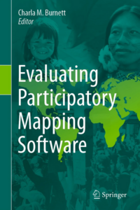
This volume provides a framework for evaluating geospatial software for participatory mapping. The evaluation is based on ten key indicators: ethics, cost, technical level, inclusiveness, data accuracy, data privacy, analytical capacity, visualization capacity, openness, and accessibility (i.e., mobile friendly or offline capabilities). Each application is evaluated by a user and cross analyzed with specific case studies of the software’s real-world application. This framework does not discriminate against assessing volunteered geographic information (VGI) applications, as a form of participatory mapping, in circumstances that its application is spearheaded by underrepresented groups with the intent to empower and spark political or behavioral change within formal and informal institutions. Each chapter follows a strict template to ensure that the information within the volume can be updated periodically to match the ever-changing technological environment. The book covers twelve different mapping applications with the goal of creating a comparative evaluation framework that can be easily interpreted by convening institutions and novice users. This will also help identify gaps in software for participatory mapping which will help to inform application development in the future and updates to current geospatial software.

Go check it out!


link.springer.com/book/10.1007/978-3-031-19594-5

Participatory mapping studies during the pandemic

The covid-19 pandemic raised great interest to study the consequences of it on green space use, outdoor recreation and mobility in cities through participatory mapping methods. Below we have collected scientific articles that have been published recently. There might be even more!

  • Samuelsson, K., Barthel, S., Giusti, M. and Hartig, T., 2021. Visiting nearby natural settings supported wellbeing during Sweden’s “soft-touch” pandemic restrictions. Landscape and Urban Planning, 214, p.104176. doi.org/10.1016/j.landurbplan.2021.10417
  • Bohman, H., Ryan, J., Stjernborg, V. and Nilsson, D., 2021. A study of changes in everyday mobility during the Covid-19 pandemic: As perceived by people living in Malmö, Sweden. Transport policy, 106, pp.109-119. doi.org/10.1016/j.tranpol.2021.03.013
  • Korpilo, S., Kajosaari, A., Rinne, T., Hasanzadeh, K., Raymond, C.M. and Kyttä, M., 2021. Coping with crisis: green space use in Helsinki before and during COVID-19. Frontiers in Sustainable Cities, p.99. dx.doi.org/10.3389/frsc.2021.713977
  • Fagerholm, N., Eilola, S. and Arki, V., 2021. Outdoor recreation and nature’s contribution to well-being in a pandemic situation-Case Turku, Finland. Urban Forestry & Urban Greening, 64, p.127257. dx.doi.org/10.1016/j.ufug.2021.127257
  • Hansen, A.S., Beery, T., Fredman, P. and Wolf-Watz, D., 2022. Outdoor recreation in Sweden during and after the Covid-19 pandemic–management and policy implications. Journal of Environmental Planning and Management, pp.1-22. dx.doi.org/10.1080/09640568.2022.2029736
  • Legeby, A., Koch D., Duarte, F., Heine, C., Benson, T., Fugigliando, U and Ratti, C., 2022. New urban habits in Stockholm following COVID-19. Urban Studies. doi.org/10.1177/00420980211070677.

covid-16, PPGIS

Using community surveys with participatory mapping to monitor comprehensive plan implementation

Comprehensive or general plans are long-range documents intended to guide future urban or regional land use, growth, and development. Structured and periodic monitoring and evaluation of plan implementation is important to identifying when plans should be revised or updated based on changed planning assumptions or conditions, but such monitoring is uncommon. In this study we present and illustrate a research-based method to evaluate general plan implementation for a case-study community located in central California. A community survey was combined with participatory mapping to assess continued public approval of key elements of the general plan: 1) residential growth, 2) community development needs, 3) preferred locations for development (spatial), 4) consistency of resident land use preferences with general plan categories (spatial), and 5) areas with the greatest potential for land use conflict (spatial). Over the five-year period following plan adoption, there was relatively little change in general resident preferences for residential growth or the perceived need for new types of urban development, with the exception of affordable housing; however, city approval of three large, mixed-use development projects, while nominally conforming to the plan, generated community conflict based on development scale and location. As a novel plan monitoring and evaluation method, a community survey combined with participatory mapping provides a means to assess consistency with plan assumptions, desired conditions, and goals and can proactively identify the potential for place-based conflicts among various interests to identify optimized community land use outcomes.


For more information see: Brown, G., Kyttä, M., Reed, P. (2022). Using community surveys with participatory mapping to monitor comprehensive plan implementation. Landscape and Urban Planning doi.org/10.1016/j.landurbplan.2021.104306


California, participatory mapping, urban planning

How to combine participatory mapping and other sensing systems in support of urban sustainability transformation

Members of the Participatory Mapping Institute have just published a journal article on “Harnessing sensing systems towards urban sustainability transformation”.  This paper presents a novel set of conceptual frameworks to show how participatory mapping, classed as an active sensing system, could be combined with passive sensing systems like big data collated from social media  to secure an inclusive, sustainable and resilient urban transformation. The paper derives principles for sustainability planning, including an iterative dialogue along a sensing loop, new modes of governance enabling direct feeding of sensed information, an account for data biases in the sensing processes and a commitment to high ethical standards, including open access data sharing.

For the full text see: Grêt-Regamey, A., Switalski, M., Fagerholm, N. et al. Harnessing sensing systems towards urban sustainability transformation. npj Urban Sustain 1, 40 (2021). doi.org/10.1038/s42949-021-00042-w

active sensing, big data, participatory mapping, passive sensing, social media

New publication exploring the pros & cons of using PPGIS data for activity space modeling

This paper focuses on the use of public participation GIS (PPGIS) data in activity space modeling and analysis and aims to draw more scholarly attention to the existing research potentials in this area. While reviewing the pros of using PPGIS for activity space studies, this paper also discusses the existing limitations and outlines how they can be addressed in future research.

Access article for free: doi.org/10.1007/s10708-021-10489-0

activity space, GIS, PPGIS

  • 1
  • 2

Participatory Mapping Institute
Copyright 2020